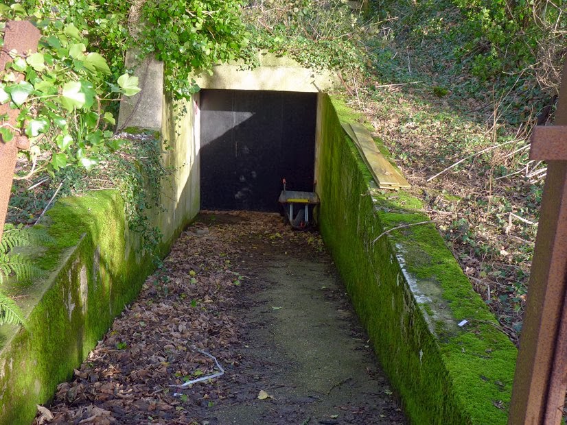
This cluster of WWII bunkers got a mention on the recent page about the Civil Defence bunker in town. I couldn't resist a look around the area. These two half buried bunkers can be seen from the lane Cache de l'Eglise, but here we seen them from the other side - from what appears to be a footpath or bridleway which runs from the first bend in the track to Leoville MRC (gun club) and turns into a farm track emerging at the junction of Rue a l'Eau and Les Ruettes to the north.
The back of the larger bunker seen from the road.
Another, NW of the rifle club...
.. and one south of that one, a hump in the field with an entrance like this.
Amongst the trees by the clubhouse, more bunkers, including this one down a ramp, with a broken fence and gate. Yes, this was the Civil Emergency Monitoring Post at St.Ouen.
There is also something concrete to see at the roadside in Rue de la Cour although it doesn't show up on Streetview.
If the footpath really is a public Right of Way, then it won't be unusual for people to be walking about here... enjoy!
Pilgrimage
-
Every year around the time of the St Helier Fete, Sunday 20th July*, *there
is a pilgrimage to lay a wreath in the hermitage of St Helier, perched high
o...
6 months ago


1 comment:
"There is also something concrete to see at the roadside in Rue de la Cour"
That was a small bunker with a tank turret which was judged to be an obstacle to traffic by a Visite Royale in the 50s so it was half demolished.
This site was Batterie Ludendorff, St.Ouens Mill was the obs post.
Thks
Post a Comment