
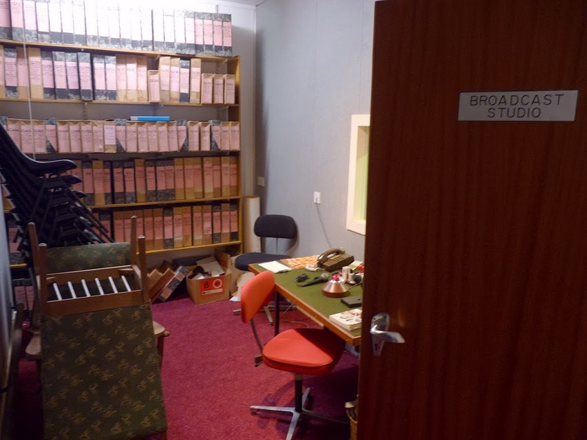
The existence of this was denied and hushed up at the time, to the point that some people still confuse it with the JT building in Trinity Gardens; so my roving reporter reports that it felt a bit unreal to be able to look around at leisure! Contrary to rumour, this was not a refuge for all the VIPs of the day to live on while the rest of us perished (for that you may have to look elsewhere!), there simply wasn't the room or supplies and although the building was far more radiation-proof than a normal building it still wouldn't have qualified as completely safe. Just good enough to fulfill its role without all that much thought - as typical for the mad times - for the grim aftermath of nuclear conflict. Let's be grateful we have one fewer thing to worry about right now :)
Many thanks to my ever helpful source for these photos from the bunker's Open Day, it looks like a fascinating place. For even more information, you can download a PDF about it : jerseyheritage Civil Emergency CS Final Report pdf - get it while you can, and someone else's visit here is recorded at http://www.subbrit.org.uk/rsg/sites/j/Jersey_civil_e_c/index.html


The lines marked on the map are to the Airport, St.Ouen (Ville au Bas), Egypt (near Les Platons), Gorey, South Hill.
Here are the codes for Jersey's Monitoring Post Bunkers :
MP15 - Vale Court, Trinity Rd, St.Helier (map)
MP16 - La Moye, near ham radio club carpark (map)
MP17 - Ville au Bas - near St.Ouen's Church (map)
MP18 - Egypte (map)
MP19 - Gorey - near Victoria Tower parking, a bunker overlooking the harbour currently festooned with aerials (map).
The bunker at Ville as Bas St.Ouen can be seen at subbrit.org.uk but it has changed a bit since those photos. You can still see the ramp beyond a broken fence and gate, and the concealed CCTV warning notice can probably be ignored, but the wooden fence has gone. The bunker is one of many around Leoville MRC (rifle club), others here being quite visible from the lane in the middle of fields, and some being mere lumps in the grass with telltale entrances. MP17 is along the track, amongst the trees just before the clubhouse. There is a bridle/foot path up northwards to Rue a l'Eau, so it can't be unusual to have people walking around. (UPDATE: I've since added a page for a look around the site)
Other locations marked on the map include :
Sirens
10 Grouville Hill
11 Gorey - Gouray Church on hill
12 St.Martin - School
13 Trinity - H.D. Farm
14 Five Oaks - Radio mast
16 Le Hocq - Mt Ube
17 Fort Regent Signal Station
20 St.Ouen - JT building opp. Farmers Inn
21 St.Lawrence - School
22 St.John - Parish Hall
23 St.Aubin - Hillside bunker above railway walk
24 St.Peter - School
25 La Moye
26 St.Ouen - St.George's
27 St.Mary - Parish Hall
? St.Brelade - Woodbine Corner
? Quennevais - Western Fire Station (pretty sure this was a siren)
? St.Helier - Rouge Bouillon School
? St.Clement - Samares School
? St.Ouen - Milano Bars site, L'Etacq
? Sion - opposite methodist chapel
? Grouville - near School
? St.Helier - Victoria College
? Rozel - Chateau.La Chaire Hotel
I remember hearing the siren tests many years ago, a haunting sound I'm glad I never had to really worry about. I hope this bunker relic from grim times is preserved as warning to future generations!
Return to bunkers index page


8 comments:
Another great post here, many thanks to you and your roving reporter for the history and photos!
I do hope you keep a good offline backup of all these posts because it would be a huge loss if something ever goes wrong with Blogger.
There is supposedly another telephone bunker near the big Kernwerk bunker at Coin Varin in St. Peter. I looked for it a few times with some other CIOS members but I don't remember anyone ever finding it. If you or any readers know the location please post a comment or get in touch through the CIOS Jersey website.
Thanks Tom, good to hear from you. I have the photos backed up, but not the text - just hoping that Google will live forever or archive.org will have copies :)
I'm not all that familiar with the Coin Varin cluster of bunkers. Can't say I've noticed the one at the Living Legend that they say is there, and apart from that all I'm aware of is at least one in a private garden on the Mont d'A. lane. Good luck on the hunt - about time there was a complete register of german concrete on the island!
On Facebook: "1 is in the Living Legend, one is the C.I.O.S one in the field and the 3rd forms part of a house on the cross roads next to the Living Legend. There are also 2 x telephone network junction bunkers with one behind the mini golf at Living Legend and the 2nd is a couple of houses down to the 3rd bunker above."
Thanks to Anonymous for the tip - I'll look again next time I'm down there.
About the offline backup, I've tested something last night and it worked. I used 'HTTrack website copier' (the Linux version) and grabbed about 3GB worth of Crapaudmatic over 5-6 hours overnight. Wonder if your page-views went way up yesterday?
Anyhow, it worked amazingly well and even downloaded every single linked download/comment/thumbnail etc, and I can browse every post locally on my computer. You should give it a go as it is an excellent option for archiving.
Hope that helps & great to see two more new blog posts this week!
Thanks Tom. "3GB worth of Crapaudmatic"... wow, I can remember when that was way more than a PC could handle :)
I'll know where to come for a copy if it all goes offline!
Hi, how would I go about visiting this please? Any contact info for someone who could help would be much appreciated. thanks, Bill
Hi Bill. Sorry I'm not sure who owns the site at the moment. You could try asking Jersey Heritage, as it was their Open Day when the photos were taken. You might have to wait until the next Open Day in the autumn.
The seldom seen bunker near the Legend (owned by them and used as a store) is just east of the minigolf, hiding under the greenery along a track here http://www.bing.com/maps/?v=2&cp=49.219728~-2.163690&lvl=20&sty=h&form=LMLTCC
Post a Comment