There are several interesting concrete remains to see at the Ronez Point loop road. Nothing easily spotted from inside a vehicle, so it's worth stretching your legs to have a look around...
In the middle of the loop, a bunker entrance can be seen...
.. steps down to...
.. a door that is open these days.
Inside, turn to the right and there's a corridor with two rooms off on the right. Not sure what these alcoves are for, anyone know?
The first 'wriggly tin' shelter (here we're facing an inland direction)...
.. and the second. I haven't seen any other twin shelters like this before, is it unique in the island?
Up on top, looking back to the road in the quarry direction. But let's look around while we're up here...
.. ooh, what's this? It's close enough to the entrance that it has to be part of the same structure, surely?
Back inside to investigate. Aha! It's not just a random pile of wood or collapsed shelves, I should have looked closer...
.. it's closing off the second entrance (lesson learned eventually - lots of shelters have two ways in/out!) and braced to take the weight of the ground on the other side.
And, outside again, just a few feet away from the blocked entrance, something with an opening on top..
.. puzzles me, this one. What was the purpose of this?
.. not exactly big in there, and why the small top opening?
Searchlight Position
From the gritty footpath, look over the low wall and you'll find a makeshift path. A twist to the right, then back seawards again down a bit of a slippery slope, and...
.. here's a fair amount of concrete. Down a bit more...
.. what a shame it's been flooded for years. It never dries out, even in mid summer - I half expect to see fish in there!
Easy enough to get to the far end (on the outside) and look back. Maybe it's a good thing it's a pool - there's no graffiti or other vandalism here.
Having pulled all the ivy down (in one go, leaving an amusingly large lattice-like bendy thing flapping on the ground) some original woodwork was revealed on the inside. I presume wooden doors gave the light a dry home until it was needed and wheeled out either side?
Another Shelter
Here's one we found on the 6th May, smothered in greenery before we uncovered it (I should have done before and after shots!), it amazed me that I'd never spotted any sign of it before. I tried to see if anyone knew about this one, and nobody seems to have known about it.
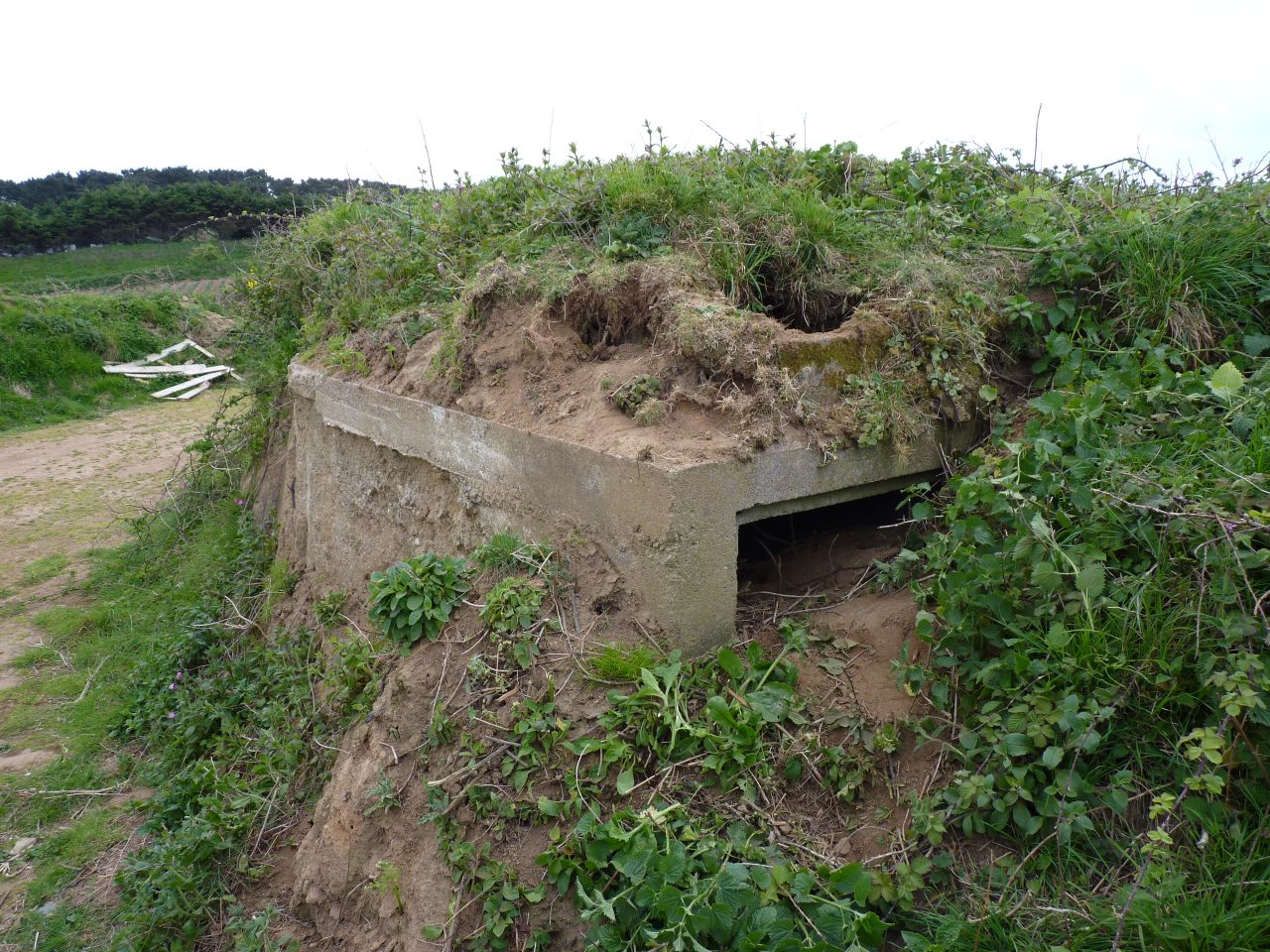
A lot of pruning later... and it's ready for other bunker spotters to notice! Easily spotted, a short stone's throw below the low wall, and not far from the searchlight position. I imagine there are steps here..
.. but a lot of ground has filled this up, so that seemed to be the end of any hope of getting in. But remember that many shelters have two entrances? So we looked around a bit, and...
.. yes! After a fair bit more pruning of Gorse, Ivy and Nasty Tree, we got to take a look inside...
.. and this would be a safer way in, for sure, if you're up to crawling along on your tum. And there's the standard tin shelter in there, one for the searchlight guys to run to when under too much attack.
You wouldn't even know the other entrance is there, from above, you have to climb down to see it. Lesson learned from recent bunker hunting : search every square foot from all angles, as some can be very hard to spot!
Now I have to say this looks like it could be very dangerous to poke around in. With all that loose earth piled up on the steps, you could be putting
yourself in deadly danger venturing inside. If that ground were to slip, you could find yourself trapped / crushed / suffocated. I'd like to see the earth removed as it looks like a good one to restore.
Finally, my usual map of the proceedings is in glorious 3D this time:

Try this
Google Maps 3D view for yourself (Windows 7 or later required) if you like. It's a great way to see the north coast, at least. Move your 'location' with mouse left click movements, use the Ctrl key as well to rotate/tilt, and the mouse scrolly-wheel to zoom in/out.
Return to bunkers index page




 Try this Google Maps 3D view for yourself (Windows 7 or later required) if you like. It's a great way to see the north coast, at least. Move your 'location' with mouse left click movements, use the Ctrl key as well to rotate/tilt, and the mouse scrolly-wheel to zoom in/out.


 There used to be a stone carving of a birdlike dinosaur head here glued to this rock, but sadly some pathetic vandals have either stolen it or pushed it over the edge.


 100 or so yachts recently visited to take part in the start of the Tour des Ports de la Manche (tourdesports50.fr)


