
 Heading down the main road from the Zoo area towards Rozel, there's a handy parking area down a track, just before the old La Tourelle...
 This parking is close to the L'Etacquerel Fort, but we're going to take the main road route first, and do the cliff paths last...
A recently new stone marking the gift of land to the NT(J) as "Le Don Berni".

Nice way to include an old gatepost into a wall - don't bother making it level!
 At this residence named after Pot du Rocheur, head down the track and don't worry about it seeming to intrude on their privacy - it is a Right of Way!
The track continues...

.. becoming a footpath to the west of a few parallel long strips of fields.
 At the end of the path before steps to the left, a small patch of woodland has been stripped down to bare ground by two-wheelers.
The path descends down some steps to join the main coastal path, with a view over to Bouley Bay.

Heading to the east, away from Bouley Bay, and the path meanders along to a headland with a house with a view...

.. I have had a request to show how this house looks these days, so here are a few photos...


The footpath crosses over the driveway...


.. what a view they have!

From the rock above the house, looking back.

.. looking over Bouley Bay - see that round thing in the water?

- that's an old boiler from some shipwreck.

The hotel at Bouley Bay...

.. and Fort Leicester by the pier.

In the other direction, the next headland features the companion Fort...

.. known as L'Etacquerel Fort...

.. closer.

.. and the lie of the land towards La Tourelle, and...

.. White Rock, with...
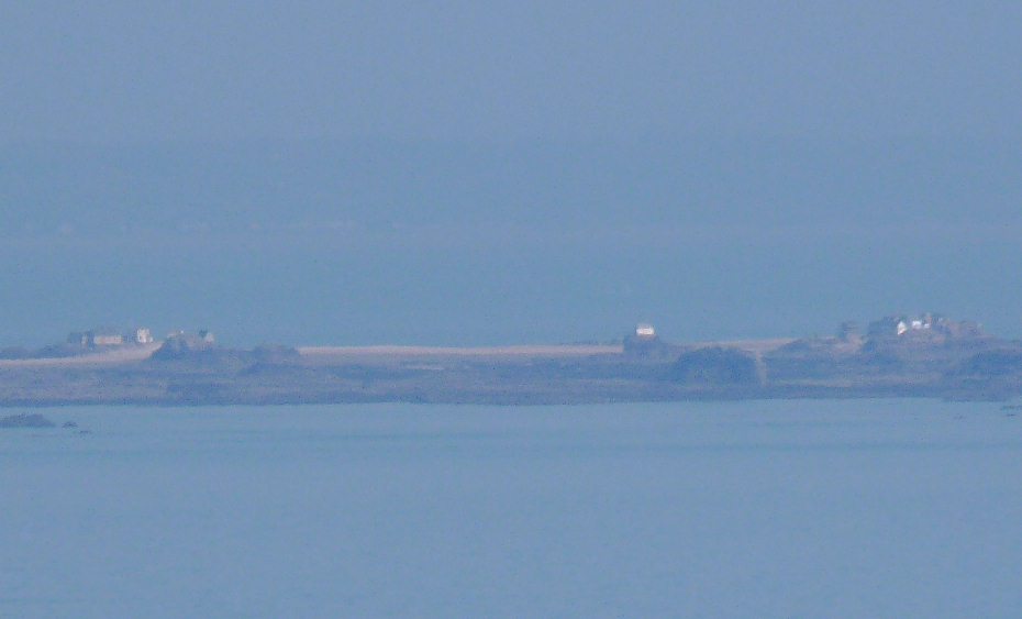
.. Les Ecrehos in the distance.
 Looking back along the path to that good viewpoint headland above that house.
If you keep to the right of the paths from here onwards, you'll head inland to the car park from whence you started.

And here's a Google Map of the route, if it helps, should you wish to have a go. It's a nice walk!


2 comments:
Fantastic, I could almost have been with you on that walk. Thank you so much for the pics and info along the way. Best wishes A.
Loved seeing the old boiler and that they have at last put railings up at fort, since it was a death trap last time i went there.
thanks for the guided tour
R..
Post a Comment