Thursday, 26 July 2012

Misc

 At Five Oaks, Victoria Cottage Homes now looks very bare indeed without the row of mature trees.
 To be dismantled.
 Looking rather purple up at Les Landes.
 There must be a massive data centre inside this house - I keep hearing about so many services keeping data in The Cloud :)
 Always on the lookout for new footpaths to explore, I found one at this bend at Maufant...
 .. it looks like a residential track... but it's been made an official footpath in recent years, apparently...
 .. and emerges here.
 It's on the phonebook map, but not Google, which has missed plenty of lanes (I've lost count already after a dozen or so, having a good look around)...
 .. like Petit Ponterrin (which the phone book map has too close to the footpath) - big enough not to miss...
 .. emerging here. If only they'd had more time with the Google Car to explore just a bit more. Still, at least we're on the map, unlike our backwards neighbour to the north west, LOL

I want to have a good nose around the Other Island on StreetView but it never seems to happen :(
 If only all roads were as clearly signposted. Here's a parish boundary stone with Mont Millais on one side, and Bagatelle Road on the other.

Lots of Jersey roads change names at seemingly random points along the way, without signage to help. For instance, when exactly in St. Brelades Bay does Mont Sohier become Route de la Baie, then La Marquanderie? Sometimes a change occurs at a junction, sometimes a parish boundary, often there's no clue for us! When does Trinity Road become Trinity Hill, then become Route de la Trinite? Did you know that the top of Mont Les Vaux at St.Aubin is actually Grande Route de St.Brelade? - you wouldn't know from any road signs; there aren't any... and when does that morph into La Route des Genets? At Woodbine Corner?

When does Mont Cochon become La Route du Mont Cochon? The map, the Welcome to St.Lawrence sign and the almanac all disagree - if you have an accident right there, which parish do you visit for the parish hall knuckle-rap? There are lanes between Queen's Valley and Gorey where the parish hasn't bothered signposting, and even the map makers seem to have given up trying to work out what they're called!

 Anyhow, rant over. Let's admire a building of the sort "They don't make 'em like that any more" (if someone tried to, it would be refused as a 'pastiche of the past' or some other excuse to deny us pleasant detail).
 An evening view along King Street...
 ... closer - a receeding row of signs.
Let's end on a chuckle, thanks to a pair of these little chaps guarding a gateway somewhere in the middle of the island.
And perhaps you'd like to explore the Black Hole of Grouville Common? Click the Go Forwards arrow twice and admire the view at night! :)

Tuesday, 24 July 2012

Misc - What's New

testing caption 1
 I hadn't realised the airport had moved. Runway 09 is a lot shorter than I remember.
testing caption 2
 Ah... the right way up, the 60th commemoration (slightly devaluing the Victory one from the occupation at the other end of the square) unveiled by Prince Charles last week...
... as his ancestor looked on.
 The Market Fountain tarted up for the Royal Visit.
Talking of princes, what used to be Prince's Hotel many years ago has changed its name from "Wack's Bar" (with an Andy Capp picture on the sign) back to Prince's.
 Someone's had a smashing time on College Hill...
 I can't think of any good reason to open it up, so I can only imagine it was accidental.

 Caught the accredited media doing an interview :)
 Another catering outlet-on-wheels at the Five Mile Road - this time at the Square Fort...
 .. closer. There's a planning application for another at La Pulente too.
 Hooray for Summer!
 And finally, I caught a secret squirrel.

Wednesday, 18 July 2012

North East - St.Cath's, Archie, Gorey

 I have actually found the time to take some shots and publish! Here's St.Catherine's Bay...
 .. the end of the breakwater, with Le Mainland behind...
 .. the Round Tower at Archirondel...
 .. beach cafe...
 .. and tower again.
 At Gorey, the castle from along the pier...
 .. the slipway and quayside...
 .. one of two castle floodlight buildings.
 Boats with the famous potato cotils behind.
 'Port Control' (not much of a port left to control - no ferries any more) and quite well desguised mobile phone masts in those chunky poles.
 For a few weeks now, some adverts for Cafe du Port, Gorey, have confused me. What's the point of an advert when it doesn't say where the (beep!) it is?! I assumed it was probably the one near the bottom of the hill (Cafe de Gouray - still with a Joyride Cafe sign there, just to confuse matters) but here it is at the end of the pier....
.. with quite extensive seating areas, as they say :)

Should be quite nice on a warm day.

Monday, 9 July 2012

Liberty Wharf - French Fare and Art

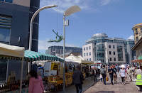
 The Norman Market appeared recently at Liberty Wharf's "Western Plaza" for the time...
 (or when the area is overrun with teenagers, "Puberty Wharf" - LOL)
Yup. Cheesy.

See that roof up on the right, suggesting that there's an extra floor above M&S?
 Yes, there is. Room for them to expand upwards, should they ever need it. Let's have a look, as there's a photo exhibition on...
 Having entered the space, facing the power station and incinerator direction, some way into the 'room'. If we look through the small window left of center...
... a view along the top of the L.W. internal corridor...
 .. closer.
 Looking back to this room's entrance, with photo appreciators in silhouette. Through the windows...
 .. a view over the plaza.
 A brighter view back to the entrance.
More of that artistic appreciation thingy going on.