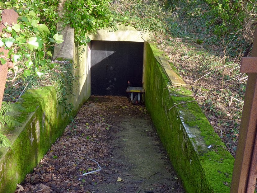
This bunker was built by the occupying Germans in WWII as a repeater station for their telephone system. During the Cold War the Civil Defense Committee pressed this secure Vale Court facility
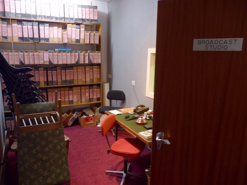
(seen from Trinity Road on Streetview) into use for the purpose of collecting information about nearby nuclear strikes and radiation levels, sharing that intelligence with allied countries over a radio network. A fairly well equipped (for its time!) broadcasting studio allowed those in charge to keep the islanders informed about unfolding civil emergency developments.
The existence of this was denied and hushed up at the time, to the point that some people still confuse it with the JT building in Trinity Gardens; so my roving reporter reports that it felt a bit unreal to be able to look around at leisure! Contrary to rumour, this was
not a refuge for all the VIPs of the day to live on while the rest of us perished
(for that you may have to look elsewhere!), there simply wasn't the room or supplies and although the building was far more radiation-proof than a normal building it still wouldn't have qualified as completely safe. Just good enough to fulfill its role without all that much thought - as typical for the mad times - for the grim aftermath of nuclear conflict. Let's be grateful we have one fewer thing to worry about right now :)
Many thanks to my ever helpful source for these photos from the bunker's Open Day, it looks like a fascinating place. For even more information, you can download a PDF about it :
jerseyheritage Civil Emergency CS Final Report pdf - get it while you can, and someone else's visit here is recorded at
http://www.subbrit.org.uk/rsg/sites/j/Jersey_civil_e_c/index.html
First, a map to show where...
.. and a layout plan with the same alignment.
The outside.
Looking out, a nice chunky door.
Ahead, decommissioned warning sirens, and peeking around the partition...
.. dull but functional.
So, back to the entrance area, and looking right...
.. emerging into a reception area, with the Ops Room to the left...
.. looking back.
To the left of the doorway to the Ops Room. Before we go in, a look around the other spaces near the reception...
The Mess Room.
Bunks in the rest area currently used for storage.
Chilling to see a sign saying "Survivor Reception Centre"...
Handouts of the time, just paint your windows white to deflect the blast and you'll be fine cowering under the stairs ;)
That cooker looks like something from Wallace and Gromit's moon trip.
I've worked in places where this kind of kitchen would have been an improvement.
From the doorway, at the top of some steps, the main Operations Room...
..looking back. Behind the head-height padded screens...
a number of positions for radio operators...
.. in contact with Guernsey and France.
One for the scanner crowd, some obsolete old frequencies. Did you find all these? :)
To the left of the studios entrance, a studio for the voice of calm to reassure us that we'll all be fine once the vomiting stops and there are no more teeth or hair to fall out.
Looking through the glass...
.. on the other side, where the knob-twiddler sits...
.. with analogue relics...
.. as if certain death wouldn't have been bad enough, just look at the audio torture we'd have been subjected to.
Connections to BBC Radio Jersey and CTV.
At the far end of the ops room, vintage PC equipment in the Met Room to track the weather and movement of radioactive fall-out clouds.
Somehow we coped with the threat of that lunatic horror looming over us.
A large map of the island. Plenty for budding historians to gaze at. WMO was the
Warning and Monitoring Organisation that this was all part of - see also ROC
Royal Observer Corps. Plenty to see too at
UKWMO Communications.
The lines marked on the map are to the Airport, St.Ouen (Ville au Bas), Egypt (near Les Platons), Gorey, South Hill.
Here are the codes for Jersey's
Monitoring
Post Bunkers :
MP15 - Vale Court, Trinity Rd, St.Helier (
map)
MP16 - La Moye, near ham radio club carpark (
map)
MP17 - Ville au Bas - near St.Ouen's Church (
map)
MP18 - Egypte (
map)
MP19 - Gorey - near Victoria Tower parking, a bunker overlooking the harbour currently festooned with aerials (
map).
The bunker at Ville as Bas St.Ouen can be seen at
subbrit.org.uk but it has changed a bit since those photos. You can still see the ramp beyond a broken fence and gate, and the concealed CCTV warning notice can probably be ignored, but the wooden fence has gone. The bunker is one of many around Leoville MRC
(rifle club), others here being quite visible from the lane in the middle of fields, and some being mere lumps in the grass with telltale entrances. MP17 is along the track, amongst the trees just before the clubhouse. There is a bridle/foot path up northwards to Rue a l'Eau, so it can't be unusual to have people walking around. (
UPDATE: I've since added
a page for a look around the site)
Other locations marked on the map include :
Sirens
10 Grouville Hill
11 Gorey - Gouray Church on hill
12 St.Martin - School
13 Trinity - H.D. Farm
14 Five Oaks - Radio mast
16 Le Hocq - Mt Ube
17 Fort Regent Signal Station
20 St.Ouen - JT building opp. Farmers Inn
21 St.Lawrence - School
22 St.John - Parish Hall
23 St.Aubin - Hillside bunker above railway walk
24 St.Peter - School
25 La Moye
26 St.Ouen - St.George's
27 St.Mary - Parish Hall
? St.Brelade - Woodbine Corner
? Quennevais - Western Fire Station (pretty sure this was a siren)
? St.Helier - Rouge Bouillon School
? St.Clement - Samares School
? St.Ouen - Milano Bars site, L'Etacq
? Sion - opposite methodist chapel
? Grouville - near School
? St.Helier - Victoria College
? Rozel - Chateau.La Chaire Hotel
I remember hearing the siren tests many years ago, a haunting sound I'm glad I never had to really worry about. I hope this bunker relic from grim times is preserved as warning to future generations!
Return to bunkers index page