Sunday 25 September 2016

Cap Fréhel visible from Jersey

Most of us are well used to seeing France to the east of us, the Normandy coast, but what about Brittany to the south? You'll need a good clear day, but there are distant views to be had...

In the distance as you drive to the end of the Noirmont headland, you may spot a section of French coast just west of south. This close up shot reveals a couple of towers...
.. turns out to be two lighthouses. "The taller one, 98ft (30m) high, with a calorie-burning 145 steps, was built in 1950 and its beam can reach up to 68 miles (110km). The smaller one, no longer in use, was constructed in 1685 by the renowned architect-engineer Simon Garangeau who worked for Vauban, the legendary military engineer of Louis XIV, who fortified many strategic points around the French coast." - www.brittanytourism.com/

Looks like a popular spot for sightseeing, why not have a look around on Streetview too? https://www.google.co.uk/maps

Plugging in the details on a helpful website gives us a distance of 55km (34 miles).


Other distant views on this blog
2011-Jan : Roches Douvres lighthouse

2008-July : Sunset over the Other Island

2010-Sept : Distant Views

2008-Aug : Distant Shores

2009-Dec : Distant Coasts

2010-May : Misc

2013-Nov : Visible Wind Farms


Wednesday 21 September 2016

Les Blanches Banques Rifle Range

A little bit of exploration on the dunes lead to a discovery that surprised me, and some rudimentary amateur archeology!

Nosing around on the "Blornsh Bonks" we noticed some stonework and found an L shape structure. Strange place for a building, and why would only two walls survive?
What we hadn't spotted was another one, a short distance away, hidden by the greenery as we'd approached. Interesting, but time to go home.
Looking on the maps revealed that there used to be a rife range here. That explains it, the L shapes pointing downrange must have been safe refuges for the guys in charge of the targets.
Returning to the scene, grabbing a shot including both refuges and trying to figure out which direction to walk along looking to see if any of the numerous stones here might be distance markers.
Only on the way down did I notice this trench...
.. and even later I spotted the remains of the where the targets must have been, in the middle of the trench, halfway between the refuges. Time to see if any stones line up...
Yes! A 150 yards marker is easily found, slightly south of the path I originally took.
Another easy find, at 250 yards.
Nothing more found until 400 yards, and I'm making this a challenge for you to find, it's more satisfying that way :)
The 500 yards stone was half buried, and is facing the wrong way, and will also give you a challenge!
Nearly back at the car park, nothing else in the correct line was found until these, but...
.. if this site can be believed (it was correct within 3 or 4 yards for the other stones), this pair of stones is 592 yards away from the butts. Is this a 600 yards marker?
A zoomed out guide to where this all is. I enjoyed finding how much still exists and was quite surprised that the ground (sand) level hasn't changed in over 100 years, for the stones to still be visible and the butts to still be in clear sight along the line of markers (give or take a tree). The same applies to the WW1 POW camp remains to the north, not swallowed up by sand after all this time.

There are a number of other granite stones here, and some tipped over concrete foundations for WW2 posts of some sort I'm guessing.

As for the range, there isn't much information out there online, except that it ceased to be used in the early 1900s. The archive may be useful if you ask for C/A5/8 ("surrender of lease on Blanches Banques rifle range") and C/A5/9 (rifle range at Blanches Banques with plan) amongst documents from 1895 to 1903.

You're going to go and look, aren't you? Enjoy your walk! (and do leave a comment if you appreciate my efforts, thanks, or give this a mention on FaceBook please)

Friday 9 September 2016

Visits to WW2 German Bunkers in Jersey

An index to my blog pages featuring WW2 German Bunkers from the occupation of Jersey, June 1940 - May 1945.
These could be found with this link, but an index is easier.
crapaudmatic.blogspot.com/search/label/WWII German bunkers
I may tidy this up and make more of it at some point :)

5 Star occupation site Must Sees
Noirmont
Corbiere
Les Landes

4 stars - still Must Sees but not quite as impressive as the main 5 star ones
Stp Le Grouin, St Brelade's / Ouaisne
crapaudmatic.blogspot.com/2016/10/strongpoint-le-grouin-st-brelades.html

RN L'Oeillere (headland between La Pulente and Petit Port)
crapaudmatic.blogspot.com/2016/11/631-and-jager-casemates-at-rn-loeillere.html
with a 631 and a Jäger open to explore (take a torch or well charged phone).


More ratings to be decided yet! Meanwhile....

Batterie Seeckt, Grouville Hill (Private Land)
crapaudmatic.blogspot.com/2018/03/batterie-seeckt-rue-au-blancq-grouville.html

Bunker Hunting at St.Catherine
crapaudmatic.blogspot.com/2017/12/bunkers-at-verclut-st-catherine.html

Damage at Sorel A
crapaudmatic.blogspot.com/2017/05/chipping-away-at-history-at-sorel-a.html

Flak bunkers at Batterie Moltke
crapaudmatic.blogspot.com/2017/04/the-battery-moltke-flak-triangle.html

RN Fliquet and Battery Haeseler
crapaudmatic.blogspot.com/2017/04/wn-fliquet-and-batterie-haeseler.html

RN Kempt Tower, St.Ouen's Bay
crapaudmatic.blogspot.com/2016/12/resistance-nest-kempt-tower.html

RN Noirmont Manor at Belcroute Bay
crapaudmatic.blogspot.com/2016/11/rn-noirmont-manor-at-belcroute-bay.html

Battery Endrass (and RN Pavilion?), Westmount, St.Helier
crapaudmatic.blogspot.com/2016/10/occupation-remnants-at-westmount.html

RN Höhe 266, Les Blanches Banques, St.Brelade
crapaudmatic.blogspot.com/2016/09/rn-hohe-266.html

RN Lewis Tower, Les Laveurs, St.Ouen
http://crapaudmatic.blogspot.com/2016/06/bunker-at-les-laveurs-slipway.html
Goodbye to the Type 646 bunker
http://crapaudmatic.blogspot.com/2014/11/goodbye-to-type-646-bunker-at-wn-lewis.html
Sunset at the tower
http://crapaudmatic.blogspot.com/2009/07/sunset-at-lewis-tower.html
2 U/WaKoFest shelters and a double-ringstand on private land here
crapaudmatic.blogspot.com/2016/12/uwakofest-shelters-and-double-ringstand.html

RN Sorel B, Sorel Point, St.John
http://crapaudmatic.blogspot.com/2016/05/bunkers-at-rn-sorel-b-sorel-point.html

RN Sorel A, Ronez Point, St.John
http://crapaudmatic.blogspot.com/2016/05/bunkers-at-rn-sorel-ronez-point.html
Earlier
http://crapaudmatic.blogspot.com/2010/04/ronez-point-and-hidden-bunker.html


La Perelle, above St.Catherine's Bay, St.Martin
http://crapaudmatic.blogspot.com/2016/05/bunker-at-la-perelle-above-stcatherines.html

OP Catillon, Grouville
http://crapaudmatic.blogspot.com/2016/05/le-catillon-roadside-german-bunker.html

RN Höhe 190, Grouville
http://crapaudmatic.blogspot.com/2016/05/resistance-nest-hohe-190.html

RN Höhe 212, Grouville
http://crapaudmatic.blogspot.com/2016/03/resistance-nest-hohe-212.html

RN Höhe 313, St.Martin
http://crapaudmatic.blogspot.com/2015/04/bunker-hunting-resistance-nest-hohe-313.html

RN Jasmin, Les Platons, Trinity
http://crapaudmatic.blogspot.com/2016/04/les-platons-bunkers-rn-jasmin.html

Waterworks Valley / Mont Gavey
http://crapaudmatic.blogspot.com/2016/03/occupation-remnants-in-waterworks-valley.html

Plemont, St.Ouen
http://crapaudmatic.blogspot.com/2015/04/traces-of-occupation-at-plemont.html

Battery Fritsch, Mt Felard, St.Lawrence
http://crapaudmatic.blogspot.com/2014/12/a-circular-walk-around-millbrook-and-mt.html

1st Battalion of the Army Coastal Artillery Regiment 1265, HQ, St.Ouen
http://crapaudmatic.blogspot.com/2014/04/the-best-view-bunker.html

RN Ville au Bas
http://crapaudmatic.blogspot.com/2014/01/resistance-nest-ville-au-bas.html

Repeater Station, Springfield, St.Helier
http://crapaudmatic.blogspot.com/2014/01/former-civil-defence-bunker-at.html

Le Fret Point Searchlight, Portelet Common, St.Brelade
http://crapaudmatic.blogspot.com/2013/11/portelet-common.html

Batterie Derflinger, St.Aubin
http://crapaudmatic.blogspot.com/2013/10/st-aubin-from-different-angle.html

quick shots at Fliquet and St.Ouen's Pond
http://crapaudmatic.blogspot.com/2013/09/i-know-what-i-did-this-summer.html

Uncovered bunker at Noirmont
http://crapaudmatic.blogspot.com/2010/08/misc.html

1 shot at Victoria Tower
http://crapaudmatic.blogspot.com/2010/04/misc_23.html

Les Landes
http://crapaudmatic.blogspot.com/2010/03/military-past-at-les-landes.html

Le Braye
http://crapaudmatic.blogspot.com/2010/02/stouens-bay-changing-light.html

Video : Archirondel
http://crapaudmatic.blogspot.com/2009/11/crapaudvision-archirondel-cottage-and.html

Video : St. Aubin - view from bunker revealed by furze fire
https://www.youtube.com/watch?v=AN-hcb2m-2k

Position up Verclut rock, St.Catherine
http://crapaudmatic.blogspot.com/2009/04/climb-up-above-st-catherines.html

Victoria Tower, after the abuse investigation
http://crapaudmatic.blogspot.com/2008/08/victoria-tower-bunkers.html

A peek at Greve de Lecq
http://crapaudmatic.blogspot.com/2008/06/misc-to-west.html

Sunday 4 September 2016

RN Höhe 266

Time to publish some shots I've been sitting on for a while. RN Hohe 266 had confused me for a while, as all I had found was the easiest to find MG and shelter, and that was nowhere near being 266ft ASL! Time for a proper search, and then to share my findings with the ever grateful world :)

Traces of War Jersey tells us there was a field gun here, two MGs, two mortars, and a searchlight. How much evidence can we find?....

The origin of the name Höhe (Height) 266 is due to the location of the main point of this resistance nest (RN, or WN from Widerstandsnest), the field gun sited at/near the 266ft point marked on the most current OS map of the time (from 1914). Note - this part of the map also shows a 43ft point where RN Steps 43 can be found.

How to find all this? From below, it's not hard to find The Ossuary. This can be found at N49 11.892 W002 13.019 - these coordinates in are 
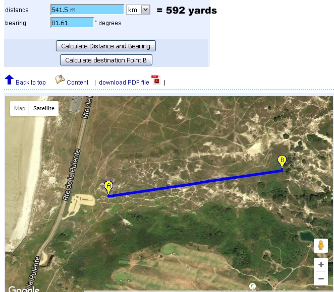
Geocaching format as that's an easy way to show them. Download a free geocaching app on you phone, type in the numbers and it will point you towards the location... easy! I will list other coordinates without the N49 and W002 parts, as all points in Jersey have this redundant part in common. You can put the coordinates into a Google search box and it will take you there on their map, converting to decimal degrees format if you prefer (in their URL).

From the Ossuary, look up straight ahead to the highest point - fancy a trek up there? Let's go... and you can even see a glimpse of concrete already, just below the top and a little to the left.
On the way up, a mystery object - any suggestions or knowledge welcomed!
And nearby that one, this. But anyway, onwards and upwards, stopping several times for a rest if you're as unfit as me. But it's really not too bad, honest!
Head left of the visible concrete to find yourself at this MG table...
.. with a protected passage to a shelter.
Jolly nice view at about 178ft up (fancy another 100ft climb soon?), at 11.866 / 12.830
Close up of the end of the passage, and a curious star shape.
Inside the shelter (only one way in/out of this one)
From above. Now head upwards, any way you like (over the bare rock or pass it), just keep going to the very highest point.
Near the summit, you may spot this, which I'm counting on being a mortar position, or I've learned nothing these last few years :)
The numbers are 11.779 on the N part, and 12.692 on the West, and it's about 240ft up.
Looking down at this position in the little 'valley'.
Close up detail. So if you reach the summit above this, you'll be around 290ft ASL, a bit knackered, but enjoying the all around views of the bay, the golf course, and the airport, etc.
Most easily spotted, a bunker in the direction of L'Etacq. We'll come to this later.
More towards the airport, something like a gathering of concrete fence posts. And on the left, some rusting metal. If you're really eagle-eyed, you may even spot a glimpse of some concrete. The rusty bit? We've found the main Hohe 266 field gun mounting!

A little history lesson, with a shot from AxisHistory.com forums, showing the field mounted 10.5cm K331(f) gun captured from the French in WW1. No concrete gun pit like you'd see at Batterie Moltke or Sorel Pt, just surrounded by sandbags and earth. Note the storage nearby at the top left of the top left photo...

.. those concrete posts were, I presume, supports for those storage areas normally in alcoves around the sides of the fully concrete gun pits. There are another two supports ahead in the bay direction.
(Bunker ahead to the right, btw, more in a moment).

Judging by the old photos, a little digging here would reveal a square concrete base.
Those supports. If you see this kind of thing anywhere else, do let us know!
Climb to the top of the little mound behind the gun mount, and... yes! An MG table to protect the main gun from any approaches from the playing fields direction...
.. and down a slope inside, a shelter I presume.
As is often the case, the shelter has another entrance, this one is even more blocked up. I'd suggest opening up the other one if you want to wriggle in, keep this location more hidden from anyone who doesn't make a point of exploring every single mound!

OK, so we've found the main gun position (and I had a reading of 265ft on my GPS, at 11.795 / 12.624), time to look at that bunker over there at 11.822 & 12.697 (247ft ASL).
A tiny opening in the door, for someone with a more suitable camera than mine. I can't get a lens AND a flash in there!
From a mound nearby, this bunker and the circular one in the distance (top left).

Time to head back down. Go to the valley over there below the mortar position, and...
.. some distance below, you may find this at 11.830 / 12.862 (same elevation as the first MG/shelter). Looks like it is subsiding a bit into the sand...
.. is this the second mortar position?
I think that's it for Hohe 266, but down at the lower level of the dunes (Blanches Banques if you prefer) there's this which I'd be keen to hear what it is...
11.752 and 13.021 on the GPS.
Oh, and a section of concrete wall at 11.816 12.986? This is quite a distance from the WW1 POW camp.

I've scribbled on a Google Maps 'satellite' shot to show the locations here, hope it helps.

If you want to get here without all the climbing and cardiac arrests, this top area of the dunes (a beautiful place well worth exploring, mostly fairly level apart from the mounds and dips easily navigated around, popular with dog walkers) can be reached from paths all around the Quennevais playing fields, and is just a short stroll from the railway walk. If you park at the rec centre (you're only supposed to if you're using the facilities) or at the roadside in the estates around the school, you can get here in less than 10 minutes without breaking a sweat.

I'm happy to share my findings with the world, and show you a little more than other websites have done, yet. If you appreciate what I do, please add a little message. And if someone would kindly share on Facebook please, so I get a few more visitors, that would be great, thanks!

Return to bunkers index page